

Rockall in 'a nutshell'
In James Fisher's words Rockall is 'the most isolated small rock in the oceans of the world'.
Another quotation, by Mr. William Ross, from 1971, also describes the rock very well: 'More people have landed on the moon than have landed on Rockall.'
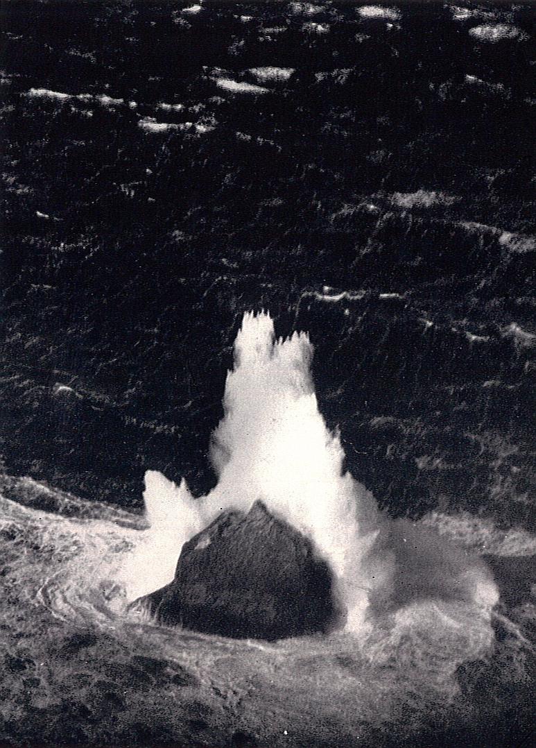
Photo of Rockall from winter 1943.
Rockall is a speck of rock with a basis of 25 to 30 m, protruding out of the stormy Atlantic about 450 km due west from the Scottish mainland up to 20 m. There is no soil, no source of fresh water and there live only a few of invertebrates and temporarily birds on Rockall.
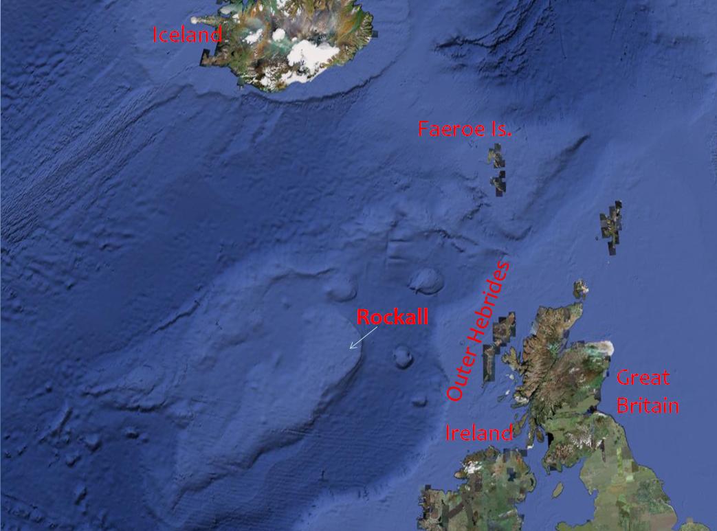
On this map (from GoogleEarth) You can see the position of Rockall. It is located about 300 km west from the nearest land, the Saint Kilda Archipelago, which belongs to the United Kingdom of Great Britain and Northern Ireland.
History
Rockall has been known to the inhabitants of the west coast of Scotland and the north coast of Ireland since long ago, as proves its role in many local myths. It was known under many simmilar names as 'Rokol' or 'Rokal' or the Gaelic name 'Rockabarraigh'.
There is a certain probablity that Irish monk Saint Brendan visited the rock as far back as in the 6th century. The first written remark of the rock comes from Scotsman Martin Martin, who mentions in his book A Late Voyage To Saint Kilda: '...and from it lies Rokol, a small rock sixty leagues to the westward of St. Kilda; the inhabitants of this place call it Rokabarra;'. Sixty leagues is about 330 km, so he considered the location of Rockall only 30 km further.
Formally, Rockall was discovered by HMS Endymion in 1810; since then name Rockall has been used.
Its position in the middle of Atlantic on the way from Europe to North America provides a danger for the ships. During the first noted wreck in 1686, about 250 lives perished; after another collision of the rock and a ship, fourth one, in 1904, (steamer Norge) about 550 people lost their lives.
Early British interest in Rockall
Since the first known expedition in 1811, many others were led on the island from different reasons; at least one from 1955 is worth mentioning: Four men were sent there to annex the rock to the United Kingdom. It was done in order to eliminate the possible spying of the testing of the United Kingdom's first guided missile in Hebrides.
After all ceremonies were done, these four men, lowered onto the rock from a helicopter on 18th September, stood at attention. Their commander, Desmont Scott, proclaimed: 'In the name of her Majesty Queen Elizabeth the Second, I hereby take possession of this island of Rockall.' Since then, the United Kingdom considers Rockall as its territory.
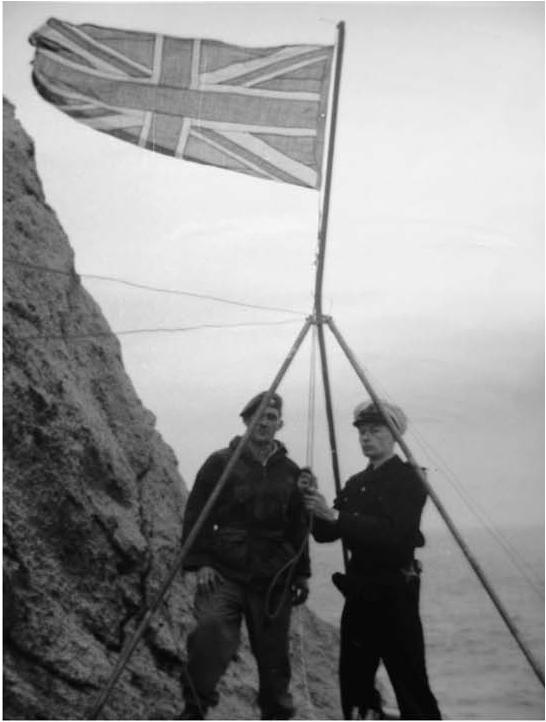
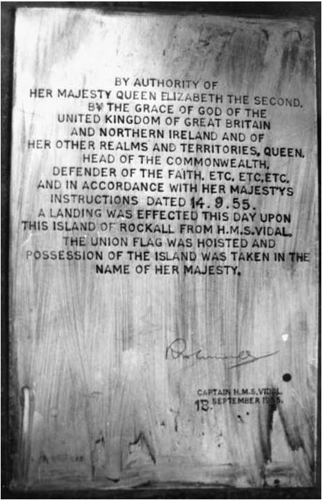
On this photos You can see the ceremonies done for the purpose of annexing Rockall - hoisting the Union Flag and fastening a plaque. It reads:
‘By authority of Her Majesty Queen Elizabeth II, by the Grace of God of the United Kingdom of Great Britain and Northern Ireland and of her other realms and territories Queen, Head of the Commonwealth, Defender of the Faith, and in accordance with Her Majesty's instructions dated the 14th day of September, 1955, a landing was effected this day upon this island of Rockall from HMS Vidal. The Union flag was hoisted and possession of the island was taken in the name of Her Majesty. [Signed] R H Connell, Captain, HMS Vidal, 18 September 1955.’
Geology
Rockall is a summit of an extinct volcano, nowadays submerged, Helen's Reef; it is its (almost) only summit above the sea-level. It consists of granite, but it has an unique composition - one part of the stone-mass, especially rich of ferro-magnesian minerals, was even called rockallite, because it does not occure on any other place in the world.
Biosphere
Only a few species of invertebrates as mites or rotifers lives on Rockall. Temporarily, birds (kittiwakes, fulmars, gannets or guillemots) use the rock for a rest. Some sea-weed grow on the sides of the rock.

The only detailed map of Rockall set by G. S. Holland and R. A. Gardiner in 1975 according to the aerial photos by the Royal Air Force from the year 1970 (according to the authors it is not much precise; its orientation also not because of strange local magnetic anomalies). The height of the rock is also unexact because of the high (in metres even during the calm weather) swing of the sea-level. The east side is 31 m (by the sea-level), the north one 25.
Originally sharp summit of the rock was cut off in 1971 to make a little horizontal plateau for a beacon.
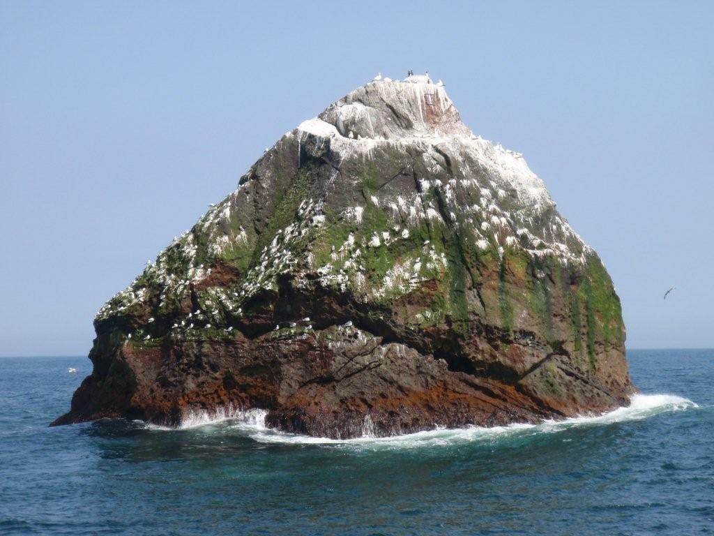
The view of Rockall from the west: The only horizonlal ledge, called in 1955 after the discoverer of the island as Hall's Ledge, is evident on the photo (few metres below the summit). Same as the navigational beacon light from 1971 (replaced in 1998), unfortunately out of use. The west side is the only slow side; you can see the birds - as well as the sea-weed. The white layer is about 1 mm thick guano, originated of the bird's excrements.
The origin of Rockall
As has been said, Rockall is a summit of an undersea extint volcano called Helen's Reef. But it is not submerged exactly. It is supposed that about 60 million years ago, when the volcano was active, it was on the land. Say, Helen's Reef protrudes out of the Rockall Bank, which was in the Mesozoic era and perhaps even in the beginning of the Tertiary between then Europe and America as so called microcontinent. The Rockall Bank is a part of the Rockall Plateau, which then (60 Ma) separated from Greenland. It is rather of American than European origin; thus Rockall cannot be classified as Europe exactly.
Oil and the political dispute
It is supposed that under the Rockall Plateau there are rich oil-fields. There grew a dispute over the Plateau (and exploiting of that) between the United Kingdom, Ireland, Iceland and Denmark (for Faeroe Islands). According to the UN Convention on the Law of the Sea each state (of this four) has a right to the Plateau and logically, there raise a conflict. The United Kingdom considers Rockall as British. Beyond its annexation in 1955, it is confirmed by the Island of Rockall Act from 1972, which incorporates Rockall into Scotland, as well. Simultaneously, Rockall lies within the 200-nautical-mile Exclusive Economic Zone of the UK.
When Rockall would be considered as an island, and as a British island, the Rockall Plateau could be British as well. But in the Convention there is also a paragraph, which sais: ‘rocks which cannot sustain human habitation or economic life of their own shall have no exclusive economic zone or continental shelf’.
Most probably for this purpose a survival expert Tom McClean was sent on the rock to live there for 40 days - to prove the inhabitability of the rock. It was not acknowledged even afterwards. He spent his time by reading and painting the Union Jack on the summit of the rock.
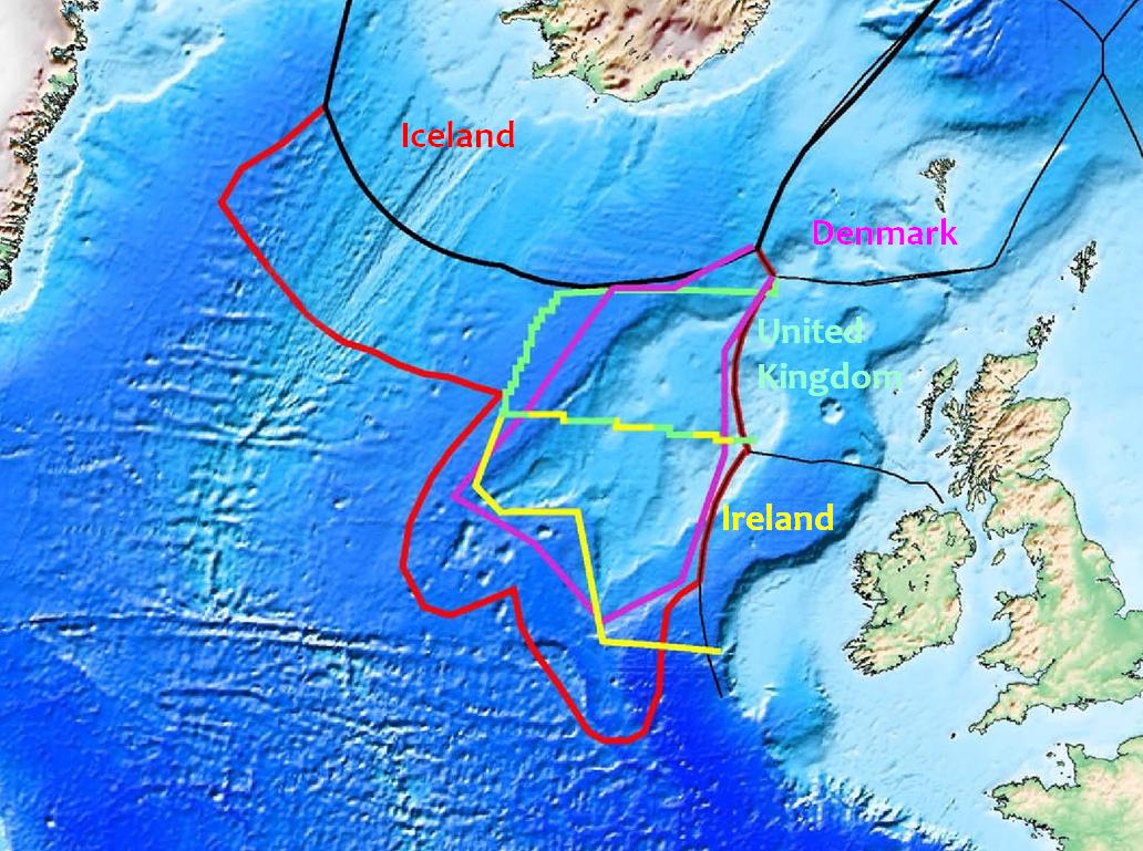
The map of the claims to the Plateau by the four states.
Greenpeace
In 1997, few activists from Greenpeace lived on the rock for 42 days as a protest against the exploitation of the oil. One of the activists claimed: ‘By seizing Rockall we claim her seas for the planet and all its peoples. No one has the right to unleash this oil into our threatened climate.’
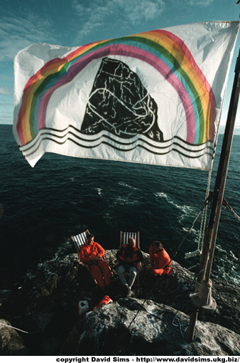
The activists declared a new global state of Waveland (its flag is visible on this photo). Through internet anyone could apply for its passport and become its citizen. Nevertheless the project ended up in 1999, when the sponsoring company corrupted. The protests were practically ignored.
Solving of the dispute
Negotiations between the diplomats of the United Kingdom, Ireland, Iceland and Denmark are in process since 2001, when the first conference for this purpose was held in Reykjavik.
From here You can go on the top, or for example on the full version of the work.